The Challenge:
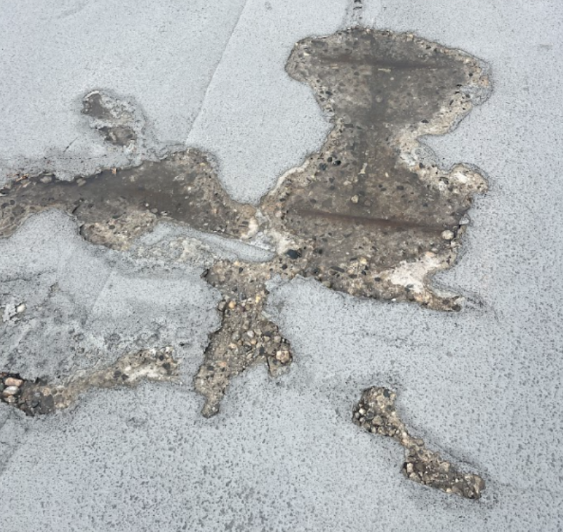
The primary challenge was to detect areas of subsurface concrete delamination that are invisible to the naked eye.
The survey area experienced heavy daily traffic, and access restrictions limited the amount of time that traffic flow could be interrupted. As a result, Xradar was tasked with carrying out a delamination survey of an area of approximately 100,000ft2 in 2 days - a task that would certainly be pushing the capabilities of a traditional chain drag survey.
To further complicate matters , sections of the parkade were required to remain open during surveying so as to let a small amount of traffic pass through to limit disruptions. This meant that ambient noise from traffic could potentially interfere with the acoustic data collection process.
Scope of Work:
Xradar’s scope included a full delamination survey of the suspended slab, including on-site (on-slab) marking and digital mapping deliverables to quantify the extent of delamination within the survey areas.
Our Solution:
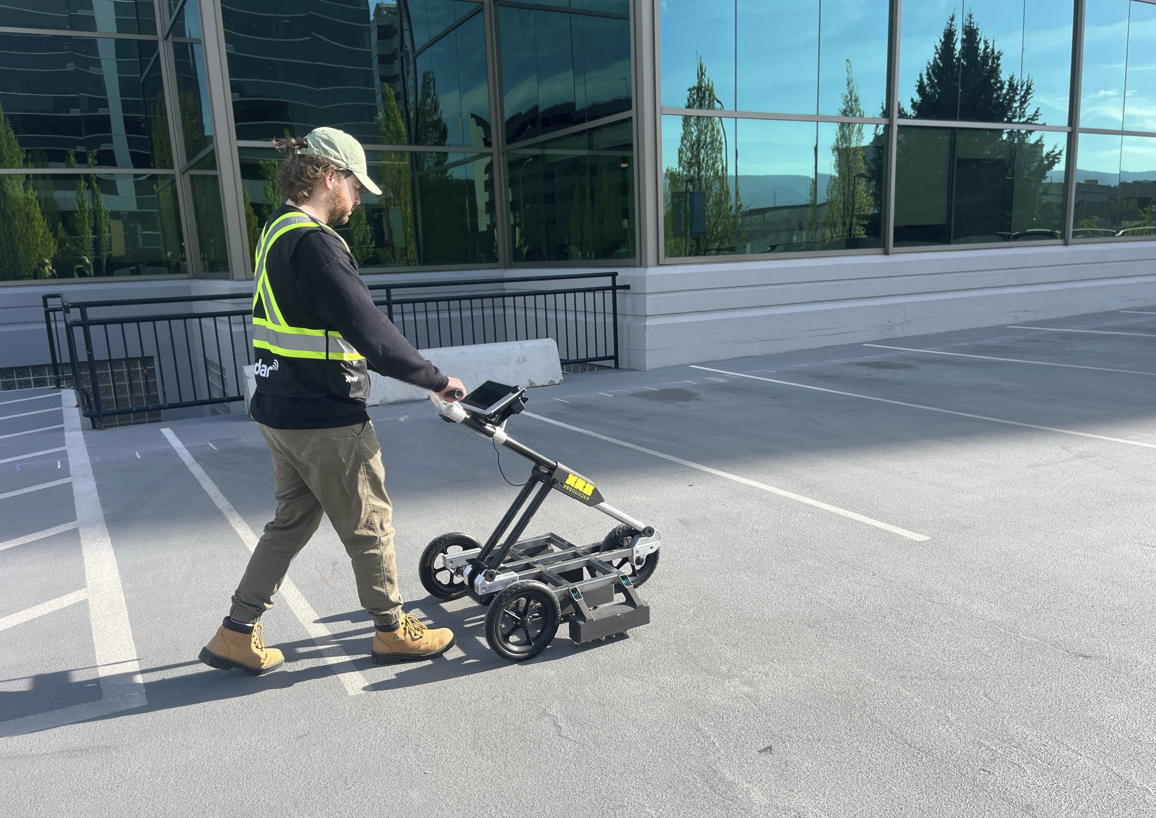
To meet the accelerated timeline, Xradar deployed the XRSounder™, - a state-of-the-art delamination detection device which was developed by the R&D team at Xradar. The device integrates a chain drag style sensor array and digital analysis into a compact, ergonomic push-cart frame. XRSounder™ employs noise isolation and band-pass filtering techniques to eliminate any external signals that might disrupt traditional chain-drag survey methods, especially in environments with high ambient noise levels.
By combining XRSounder™ with Xradar’s high-precision laser scanning capabilities, we delivered a comprehensive and objective map of subsurface defects across the parkade slab.
Methodology:
Xradar technicians initially marked out a survey grid using alignment tools, with gridlines marking in 1m increments, which is the width of each swathe/pass of the XRSounderTM. Once the gridlines were set, data acquisition began by simply pushing the unit and monitoring real-time feedback on the digital console. In this case, the client requested both physical slab markings and post-processed digital outputs. Our proprietary post-processing software XRMapper handled data processing with ease. Thanks to the XRSounder’s enhanced efficiency, our team completed the survey significantly faster than traditional methods. After data acquisition, a laser scanning survey was conducted to provide detailed 3D spatial documentation, enabling an overlay of delamination data onto the scanned environment.
Findings/Results:
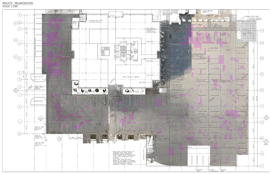
Our survey results were able to provide the client with a detailed and objective map of the surface-level parkade, including all the areas of concrete impacted by delamination. The digital map provides the exact area of the concrete delamination. All of this compiled into a final report allowed the client to make informed decisions when proceeding with contractors who will be able to repair the impacted areas.
Conclusion:
Using Xradar’s highly advanced scanning methods, we were able to successfully complete the project within the tight time-frame—without interference from the external environmental/ambient noise, and with minimal disruption to regular traffic flow. The client was left with confidence that all critical subsurface defects had been detected, documented, and addressed for repair planning.
Do you have a similar project that you’re working on? Get in touch now, and we’ll show you the power of XRSounder™.